
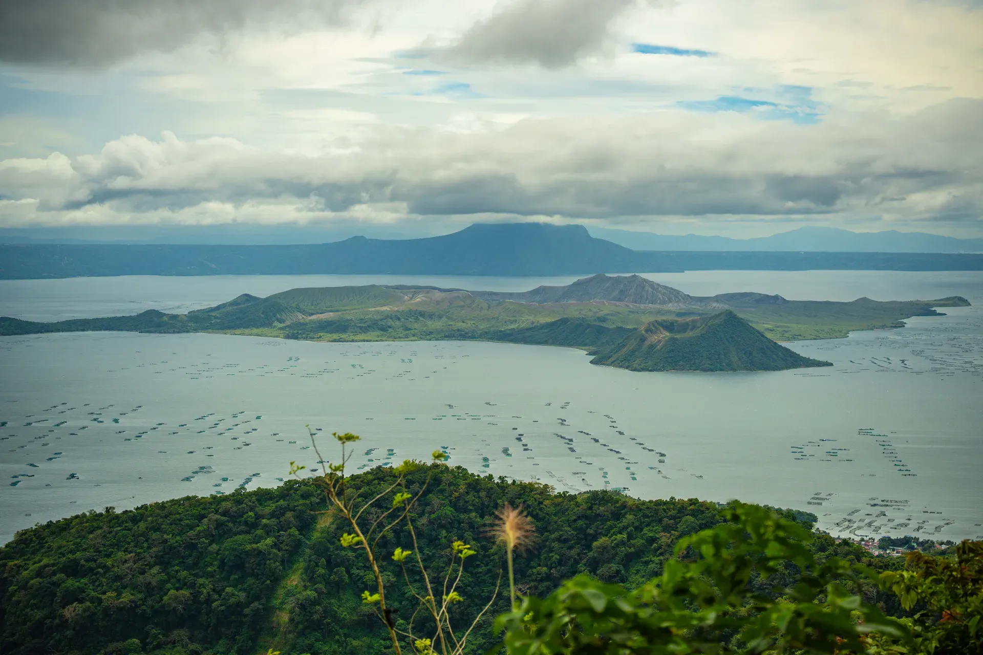
Taal Volcano sits 50 kilometers south of Manila as a highly active complex caldera. Its concentric geography features an island within a lake, resting on an island within a larger lake.
Taal Volcano operates as a highly active complex caldera system 50 kilometers south of Manila in Batangas province. The structure defies standard volcanic cones. A massive 18-mile-diameter depression holds the 265-square-kilometer Taal Lake. In the center of these deep blue waters sits Volcano Island, a 23-square-kilometer landmass built from 47 overlapping cones and craters. This island contains its own body of water, the 1.2-square-kilometer Main Crater Lake. A tiny rock formation called Vulcan Point emerges from this inner lake, creating a rare geographical phenomenon of an island within a lake, on an island within a lake.
Designated as a National Geological Monument in 1998 and a national park in 2018, the site demands respect. It ranks as the second most active volcano in the Philippines. The United Nations classifies it as one of 16 Decade Volcanoes globally due to its violent eruptive history and proximity to heavily populated metropolitan areas. Volcanic ash and sulfur dioxide routinely vent from the crater, altering the local air quality.
Prior to recent eruptions, a typical visit took two to three hours. Tourists paid a ₱100 environmental fee in the lakeside town of Talisay before boarding motorized outrigger boats for a 20-minute crossing. The hike up the dusty 400-meter elevation exposed visitors to intense heat and active steam vents. The Philippine Institute of Volcanology and Seismology (PHIVOLCS) currently enforces a Permanent Danger Zone across the entire inner island. Check the official daily bulletins before planning any trip to the lakeside towns, as sudden seismic swarms frequently trigger immediate road closures.
Massive prehistoric eruptions between 140,000 and 5,380 BCE carved out the 18-mile-diameter Taal caldera. These colossal explosions collapsed the original volcanic mountain, leaving behind a massive depression that eventually filled with rainwater and regional runoff. Early remnants of these ancient geological events still stand today, most notably the Batulao cone on the western edge of the caldera. The resulting fertile volcanic soil laid the groundwork for future agricultural settlements along the lake shores. The caldera walls formed a natural barrier, trapping water and creating a unique micro-ecosystem.
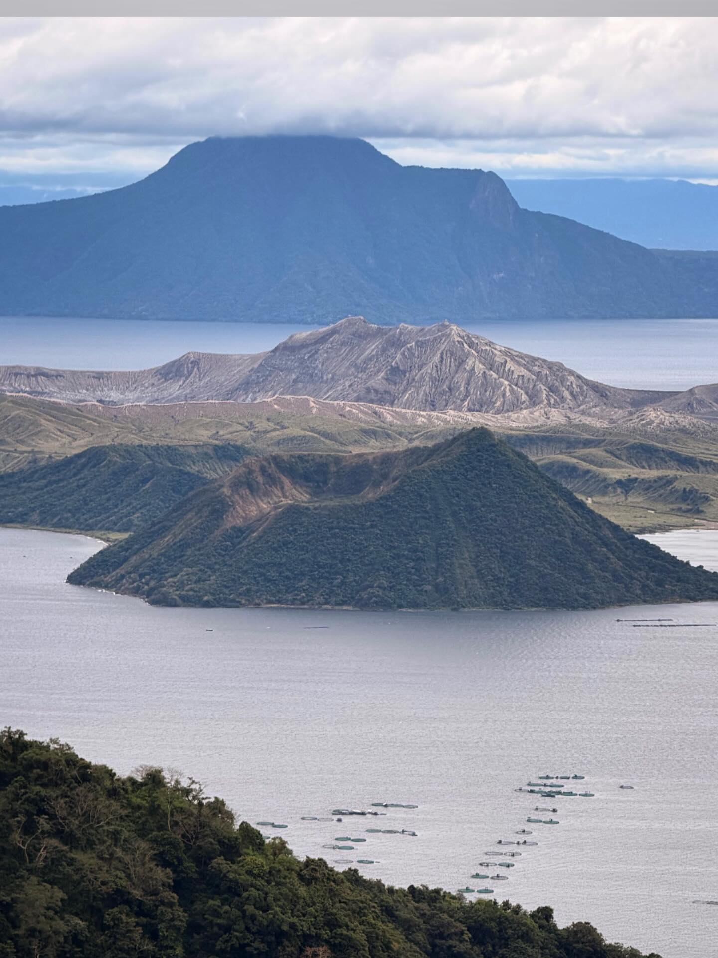
Spanish colonizers recorded the first historical eruption in 1572. Since that date, the volcano has erupted 39 times, claiming over 5,000 lives. A VEI 2 eruption in 1707 built the prominent 263-meter-tall Binintiang Malaki cone on the northwestern tip of Volcano Island. Many tourists mistakenly photograph this distinct cone thinking it is the main crater. The most destructive historical event occurred in 1754, when an eruption lasted 200 days and buried four lakeside towns. In September 1965, a devastating VEI 4 eruption blasted a new crater open. This event generated deadly base surges—hurricane-force clouds of hot gas and ash—that swept across Lake Taal and destroyed villages on the mainland. The ruins of the old San Nicolas settlement still sit along the shoreline at coordinates 13°55' N, 120°57' E, half-buried by centuries of ash and mud.
A sudden phreatic-to-magmatic eruption shattered a 43-year period of quiet on January 12, 2020. The volcano blasted a nine-mile-high ash plume into the atmosphere, forcing the immediate evacuation of 30,000 lakeside residents. Thick gray ash blanketed the Calabarzon region and shut down airspace over Metro Manila. The eruption altered the island's geography, boiling away portions of the Main Crater Lake and leaving deep fissures across the surrounding mainland roads. Today, the government maintains a strict ban on island access. Coast Guard patrols actively intercept unauthorized boats attempting to cross the lake, revoking the licenses of operators who risk illegal trips.
The Taal caldera sits directly on the southwestern end of a convergent boundary between the Eurasian and Philippine Sea tectonic plates. This volatile positioning fuels a complex system of 47 overlapping cones and craters across the 24-square-kilometer Volcano Island. The terrain consists of loose volcanic ash, hardened basalt flows, and steep, dusty ridges. Ground temperatures on the island routinely exceed normal levels due to active steam venting directly through the porous rock. The island rises to a maximum elevation of 400 meters, creating a rugged profile against the flat expanse of the surrounding water.
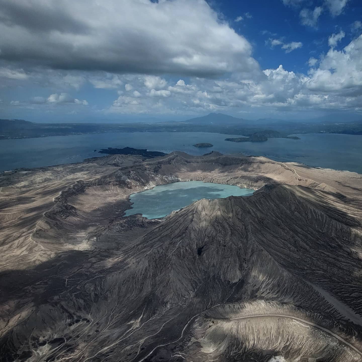
Taal Lake fills the primary caldera depression with 265 square kilometers of fresh water. The lake floor drops to depths between 100 and 150 meters, concealing active underwater vents that occasionally release large bubbles of toxic gas. High sulfur concentrations give the 1.2-square-kilometer Main Crater Lake its distinct emerald-green color. Active fumaroles line the inner crater walls, continuously emitting thick white plumes of sulfur dioxide that drift across the water. The chemical composition of this inner lake fluctuates wildly depending on the magma movement below the surface.
Vulcan Point anchors the center of the Main Crater Lake. This small rocky protrusion is a remnant of the old crater floor that survived subsequent collapses. Before the 2020 eruption, tourists could hike up the sun-drenched slopes to the Red Lava Viewpoint for an additional fifty pesos. The trail exposed hikers to intense heat, zero shade, and abrasive volcanic dust kicked up by local horses. The current Permanent Danger Zone classification means visitors now observe these geological features from the Tagaytay Ridge, located 9 kilometers north and elevated safely above the toxic gas emissions.
The fertile soils surrounding the caldera have dictated the agricultural economy of Batangas for centuries. Volcanic ash breaks down into mineral-dense earth, supporting extensive coffee plantations along the Tagaytay ridge and mainland slopes. Farmers cultivate Kapeng Barako, a distinct Liberica coffee variety that thrives in this specific microclimate. The constant threat of eruption forces a cyclical relationship with the land. Communities build, evacuate, and rebuild, relying on the volcano's soil for their livelihood while facing its destructive capabilities.
The historical town of Taal, established in 1572, sits an hour away from the lake. This municipality preserves Spanish colonial architecture and houses the Basilica of St. Martin of Tours, the largest Catholic church in Asia. Local artisans in this district maintain centuries-old traditions of hand-embroidery and the forging of balisong knives. The town's original location was actually on the shores of the lake, but the catastrophic 1754 eruption forced the entire population to relocate to its current, safer position on a hill facing Balayan Bay.
The geography isolates lakeside fishing villages from major urban centers. Fishermen navigate the 265-square-kilometer lake daily to harvest tawilis, the only freshwater sardine in the world. This species evolved specifically within the confines of the caldera after prehistoric eruptions sealed the lake off from the ocean. Overfishing and volcanic water pollution currently threaten the tawilis population, prompting strict seasonal fishing bans by local authorities. Visitors buying fish from local markets should verify the species to avoid contributing to the decline of this endangered endemic fish.
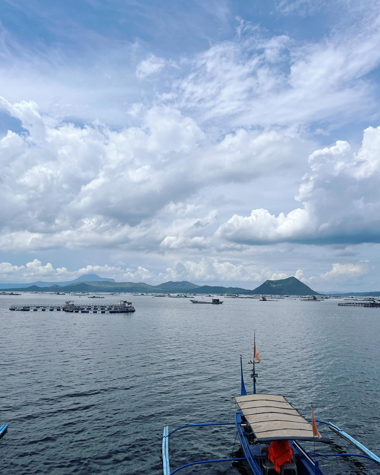
The United Nations lists Taal as one of 16 Decade Volcanoes globally due to its extreme hazard to the nearby Manila population.
Taal Lake is the only place in the world where you can find tawilis, a marine sardine that evolved to survive in fresh water.
Before the island closed to the public, local vendors charged tourists a small fee to hit golf balls directly into the active crater.
The prominent Binintiang Malaki cone visible from Tagaytay is actually a flank cone formed in 1707, not the main active crater.
During the January 2020 eruption, extreme underground heat completely boiled away portions of the 1.2-square-kilometer Main Crater Lake.
Vulcan Point is a rocky island sitting inside a lake, which is on an island, which is inside a larger lake on the island of Luzon.
The ruins of the original town of Taal lie half-submerged in the lake at San Nicolas, destroyed by a massive 200-day eruption in 1754.
The Philippine Government enforces a Permanent Danger Zone across Volcano Island due to unpredictable seismic activity. Landing on the island and hiking the trails are strictly prohibited. Violators face penalties from the Coast Guard.
Scientists have recorded 39 historical eruptions since 1572. These events have caused over 5,000 deaths and repeatedly reshaped the island's geography.
The system features a rare concentric structure. Vulcan Point is a small rock island located inside the Main Crater Lake, which sits on Volcano Island, surrounded by the massive Taal Lake.
When access was permitted, a roundtrip motorized outrigger boat from Talisay cost between ₱1,500 and ₱2,000 for up to seven passengers. Currently, commercial tourist boats cannot legally cross to the island.
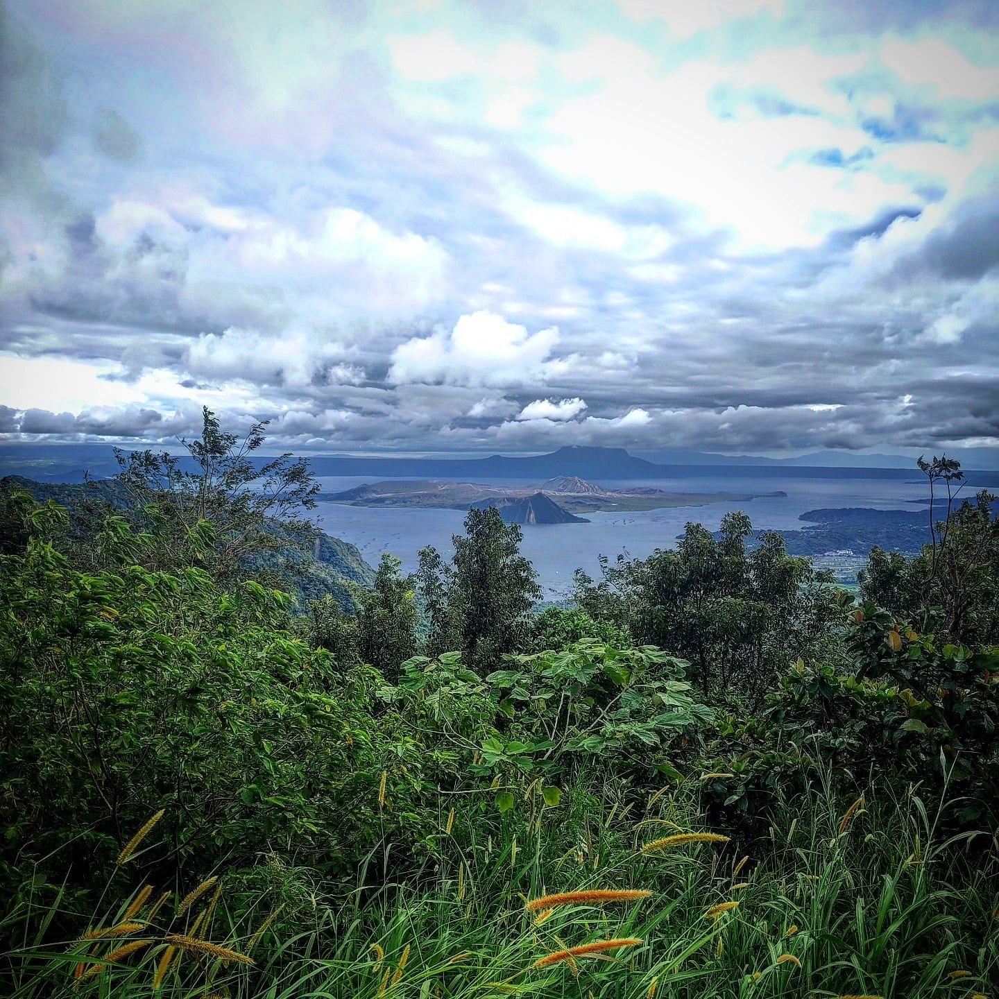
Tagaytay City sits 9 kilometers north on the elevated caldera rim, offering the safest and clearest panoramic views. Popular vantage points include People's Park in the Sky and various ridge-side restaurants.
A sudden phreatic-to-magmatic blast on January 12, 2020, sent an ash plume nine miles into the sky. The event forced 30,000 people to evacuate and blanketed Metro Manila in thick volcanic ash.
The massive caldera lake reaches depths between 100 and 150 meters. It covers 265 square kilometers and conceals several active underwater volcanic vents.
The International Association of Volcanology designated Taal as a Decade Volcano because of its violent eruptive history and its location just 50 kilometers south of densely populated Metro Manila.
Swimming is highly discouraged due to sudden releases of toxic volcanic gases from underwater vents. The water also contains high levels of sulfur and agricultural runoff from nearby towns.
The distinct, photogenic cone seen from the northern ridge is Binintiang Malaki. It is a dormant flank cone created during a 1707 eruption, while the actual active crater sits lower and flatter in the center of the island.
Browse verified tours with free cancellation and instant confirmation.
Find Tours